Interactive model helps stakeholders plan for Bay health goals
Online tool quantifies oysters’ contribution to “pollution diets”
When an oyster filters food from Chesapeake Bay, it contributes not only to its own growth, but also to the health of Bay waters. That’s because the materials it ingests—typically algal cells and bits of detritus—would otherwise be fueling the nutrient pollution and turbidity that have obliged watershed states to adopt “pollution diets.”
Recognizing this vital role, a federal panel is close to submitting oyster-reef restoration for consideration as a “best management practice" for removing nitrogen, phosphorus, and suspended sediments from Bay waters as part of the landmark Chesapeake Bay Watershed Agreement.
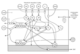 Now, researchers at the Virginia Institute of Marine Science and the University of Maryland Center for Environmental Science have developed a web-based, interactive computer model that allows stakeholders to better plan and implement their restoration efforts. Leading the modeling project were VIMS researchers Lisa Kellogg and Mark Brush, along with UMCES researcher Jeff Cornwell. The project was funded by The Nature Conservancy and the Oyster Recovery Partnership.
Brush says “Our model is available online for anyone to use—restoration practitioners, planners, educators, scientists, or members of the public—but our primary goal was to get this type of decision-support tool directly into the hands of resource managers. 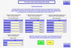 That is extremely rare and has great potential for use around the Bay and in other estuaries.”
Bruce Vogt, Ecosystem Science and Synthesis Manager at the NOAA Chesapeake Bay Office, says "We can see the tool being used in many ways—from scientists investigating the relative benefits of different restoration scenarios to people implementing water-quality best management practices using oysters."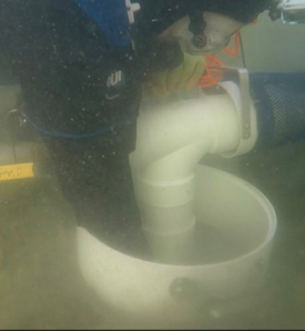
“We developed the model so that resource managers could easily estimate the TMDL-related benefits of oyster-reef restoration,” adds Kellogg. TMDLs—Total Maximum Daily Loads—are similar to the "recommended daily allowances" found on food labels, and indicate the maximum amount of a pollutant that can enter a water body without causing a water-quality indicator to cross a defined threshold. They are the cornerstone of current court-ordered efforts to restore the Bay.
Kellogg notes that development of the model began in 2014, with Harris Creek as the modeling testbed. This small drainage on Maryland’s bayside Eastern Shore is one of 10 tributaries targeted for oyster-restoration activities under the Chesapeake Bay Program’s renewed efforts to protect and restore the Bay watershed as outlined in the Chesapeake Bay Watershed Agreement of 2014. Reef construction is now complete in Harris Creek and the Little Choptank River in Maryland; and ongoing in Maryland’s Tred Avon River, as well as the Great Wicomico, Lafayette, Lower York, Lynnhaven, and and Piankatank rivers in Virginia.
“Resource managers can run different restoration scenarios in Harris Creek to optimize restoration planning and implementation, and to calculate the benefits of the chosen plan,” says Kellogg. “The model is rooted in scientifically defensible data and designed to be readily transferable to systems throughout Chesapeake Bay and the Eastern Shore.”
Brush says that because “most of the current restoration activities in the Bay have already been planned in terms of how many oysters they’re planting and where,” near-term use of the model will be “primarily to compute restoration benefits.” Indeed, Emily Skeehan, who earned her Master’s degree from William & Mary’s School of Marine Science at VIMS in 2015, has already used the original version of the model to calculate oyster-restoration benefits in the Lynnhaven River. And Brush has a new project to adapt the model for use in computing the benefits associated with a restoration project in North Carolina’s New River Estuary.
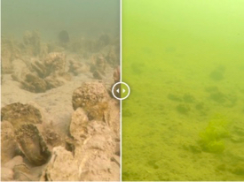 But Brush says the model could be used earlier in the restoration process during future projects, or to fine-tune current restoration plans “to find optimal planting locations to get the biggest bang for the buck. That, along with application of the model to the other Bay tributaries undergoing restoration, is definitely our plan moving forward,” he says, “pending funding.”
Model components
The foundation of the Harris Creek Model is Brush’s estuarine ecosystem simulation model, which computes how water masses, nutrients, and suspended particles move into and through a tidally-influenced waterway such as Harris Creek.
Coupled to this ecosystem model is an oyster sub-model that uses knowledge of oyster biology and ecology to compute the quantity of water, algal cells, suspended solids, and nutrients that oysters filter, incorporate into their tissues, or recycle back into the Bay. The sub-model also computes oxygen consumption and the amount of nitrogen and phosphorous removed by the sediments beneath restored reefs.
Most recently, the research team has enhanced this coupled model by updating water-quality records to 2016, and by replacing generic oyster-related data with data collected in Harris Creek by VIMS researchers through a project funded by NOAA. Their updated model also incorporates the impacts of two common oyster-reef associates—a mussel and a “sea squirt.” Like oysters, these organisms feed by filtering particles from the water—adding them to the model thus makes it more comprehensive and improves its accuracy.
Model performance
An important step in any modeling study is to gauge the model’s performance by comparing its projected values with real-world observations. In Harris Creek, this validation process—using data collected by permanent sensors and field crews—shows that the oyster-TMDL model does indeed accurately reproduce key measures of water quality and oyster growth, especially on a seasonal basis.
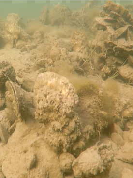 In turn, model results indicate that restored oyster reefs in Harris Creek have led to a 11.9% decrease in the concentration of chlorophyll—a proxy for the abundance of algal cells and nutrient pollution—and a 15.1% decrease in the suspended particles that cloud the water.
Kellogg says the model also indicates that “Denitrification was the dominant mechanism by which restored reefs remove nitrogen from the system, followed by incorporation within oyster shells and tissues, and burial into sediments.” Denitrification is the process by which organisms reduce nitrate and nitrite—compounds that fuel over-fertilization of coastal waters—to nitrogen gas, which is harmless to aquatic habitats.
Though these modeling results look promising, the researchers caution they must be viewed in context. For instance, Kellogg notes that “Despite the large percentage decreases in chlorophyll and total suspended solids, the absolute changes in these parameters were predicted to be very small.”
And although the restored reefs appear able to remove far more nitrogen from Harris Creek than is carried in from the watershed or atmosphere, Brush says “Most of the nutrients and sediments entering the creek come from the nearby Choptank River, and reefs are able to remove a much smaller fraction of those inputs.” The restored reefs were able to remove less than 10% of the total inputs of nitrogen, phosphorous, and organic carbon.
The bottom line, though, is still positive. “Removal by the restored reefs of more than 20% of the suspended sediments coming from the Choptank and nearly a quarter of phytoplankton production within the creek is substantial,” says Kellogg.
Brush adds, “Even relatively small nutrient removals are important in a TMDL context because they add up.” He notes that in the case of Harris Creek, the restored oysters are able to remove an amount of nitrogen equal to what comes from the watershed, plus additional nitrogen coming from elsewhere in the Bay.  Moreover, preliminary simulations with the model by The Nature Conservancy show that the model-predicted benefits are in a reasonable range relative to the cost of the Harris Creek restoration.
“Overall,” says Brush, “Harris Creek represents a truly impressive system-level restoration effort. The model we developed is one example of our efforts to serve management-focused models online for direct use by stakeholders. It is widely applicable around Chesapeake Bay and beyond, and we look forward to continuing to make these tools directly available to managers and restoration planners.”


