MapMyShore

MapMyShore
Partnering with the community to map Virginia’s shoreline features
The Virginia Institute of Marine Science (VIMS) has been developing Shoreline and Tidal Marsh Inventories since the 1970’s. These inventories assess conditions along tidal shorelines. They provide important baseline information to support shoreline management and improve the decision-making capacity of many stakeholder groups.
MapMyShore v1.0 is an application that allows the community to assist VIMS with collecting and ground-truthing shoreline inventory features critical to natural and cultural resources.
How to Get Started
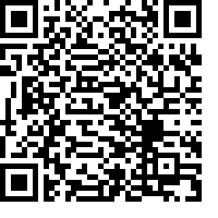
Download ArcGIS Survey123 from the app store, then scan this QR code:

Glossary of Shoreline Features
View Results
Visit the Virginia Coastal Resources Tool dashboards for a display of MapMyShore reports. Each report must be reviewed for accuracy before being incorporated into the shoreline inventory.
MapMyShore Community Engagement Dashboard
Contact Us
This project is being conducted by the Center for Coastal Resources Management at the Virginia Institute of Marine Science (VIMS) in partnership with the Northern Neck Planning District Commission (NNPDC). This project is funded by the National Oceanic and Atmospheric Administration (NOAA) - Virginia Coastal Zone Management Program (VA-CZMP). Grant# NA 23NOS4190255.
