
Roanoke
John White, Frankfort, 1590
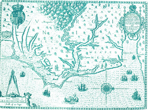
This map has many "firsts". It put the Chesapeake Bay "on the map", and contains the first printed use of the name "Chesapiooc Sinus" (Chesapeake Bay). It is the first separate map of Virginia with any degree of accuracy and detail. It remained the basic prototype of the mouth of the Bay until John Smith's Map in 1608. A highly decorative map, it depicts trees, mountains, and Indian villages, as well as the location of shoals.