
U.S. Coastal Survey
1856
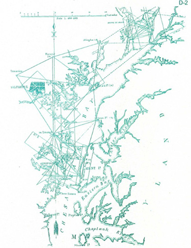
This chart of the Chesapeake Bay, made in 1856 by the U.S. Coastal Survey, reveals the triangulation work that was done in the Chesapeake Bay area. This gave the necessary controls that were needed to establish the shoreline accuracy of the Bay and the rivers involved. These were published in an annual accuracy of the Bay and the rivers involved. These were published in an annual report made by the Superintendent of the U.S. Coastal Survey to Congress.