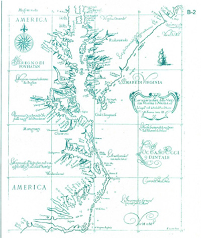
Carta Particolare della Virginia Vecchia e Nuoua, which covers the lower two-thirds of the Chesapeake Bay to Cape Fear, is the first of the area to be done on the Mercator projection, thus facilitating navigation. The Delmarva Peninsla and many Indian names appear to be based on Smith's map of 1612. The North Carolina portion is from John White. The map appears in the atlas Dell Arcano Del_Mare, which is one of the earliest and rarest of marine atlases and is the first by an Englishman.