
America
Abraham Ortelius, Antwerp, 1587
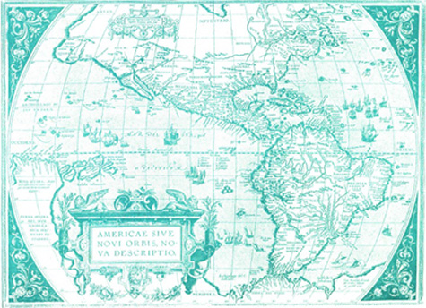
This map, printed in 1587, depicts the general knowledge of the world at about the same time that Roanoke and Jamestown were settled. Although the coastline of North America is substantially accurate, the interior is nearly blank. The Great Lakes were still unknown. This map was included in an atlas prepared by Ortelius, who produced the first modern atlas of the world in 1570.