Map
Vessels
Photos
Ports
Containers
News
Services
Paid
Plans & Prices
RealTime AIS Data
Historical AIS Data
Container Tracking
Free
News
Mobile Apps
Route Planner
Fleet Explorer
Embed map
Become AIS Partner
Contact us
Recent searches
✕
Clear History
Standard map
Simple map
Dark map
Satellite map
Nautical charts
Off
Temperature
Wind Speed
Waves
+
–
i
Show My Fleets
Hide Satellite positions
Measure Distance
Refresh map
Show My Fleets
Hide Satellite positions
Measure Distance
Refresh map
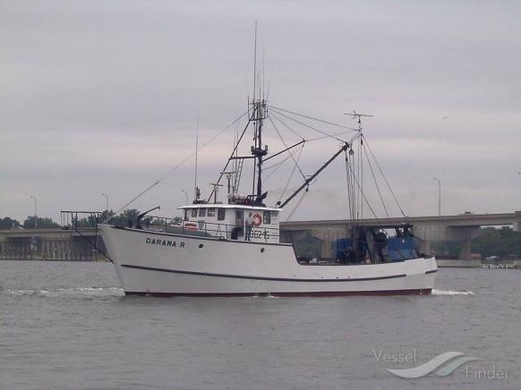
DARANA R
Fishing vessel
Details
Track
Add photo
Add to fleet
Destination
ETA: -
Speed:
0.0 kn
Course:
71.1°
Draught:
-
Status:
-
Last report:
Apr 02, 2025 18:18 UTC
Last Port
Port Calls
Weather
Vessel Particulars
Gross Tonnage:
-
Built:
-
IMO:
-
Deadweight:
-
Size:
27 / 7m
MMSI:
367174730